Hurricane Erin: From Cape Verde Devastation to Atlantic Threat
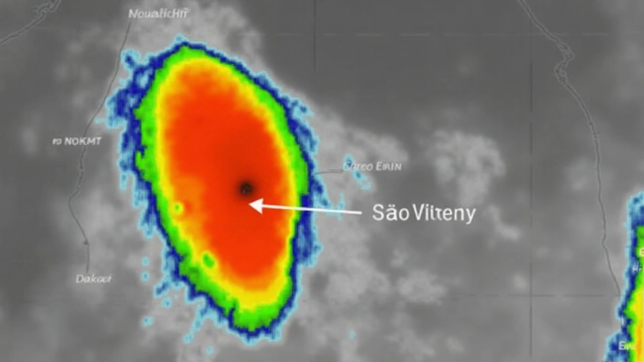
Hurricane Erin's arrival in the Atlantic hasn't just marked the official start to the 2025 hurricane season—it's rewritten what a powerful tropical storm can do in August. Erin first gathered strength near Cape Verde, hammering São Vicente with nearly 180mm of rain in less than half a day. Streets in Mindelo, the main city, turned into rivers, and homes were washed away. Local officials counted nine people dead and declared a state of emergency for both São Vicente and nearby Santo Antão. The devastation has left entire communities in shock, with thousands scrambling for food, shelter, and clean water.
After pounding Cape Verde, Erin didn't let up. Fuelled by a pocket of warm ocean water, it rapidly intensified—going from a lesser storm to Category 5 status in less than 48 hours. That's the kind of jump meteorologists raise their eyebrows at. Winds hit a peak at 160 mph, the sort you only see in historic storms, and pressure dropped drastically, signaling more strength to come. Though Erin has since dipped to Category 4 with winds now clocked at 130 mph, that's still enough to keep forecasters on edge.

Is the UK in Erin’s Path?
Right now, Erin is spinning about 695 miles southwest of Bermuda, with Bermuda and the US East Coast both bracing for dangerous surf and rip currents. The National Hurricane Center states there are no signs Erin will go ashore on the American mainland, but New England, the southeast US, and even the Canadian Maritimes will feel its reach in the surf and unpredictable weather patterns.
The real anxiety, especially for those watching from across the pond, is Erin’s next move. The projected path shows the hurricane curving northeast mid-week, threading a line between Bermuda and the US while staying well off shore. If this holds, Erin will continue pushing across the Atlantic, headed in the general direction of Western Europe. That's got UK forecasters on high alert. The size of Erin’s wind field means even a weakening Hurricane Erin could send stormy weather, heavy rainfall, or hazardous gusts Britain's way within the week.
UK weather services are keeping a close watch. While direct hits from hurricanes are rare in Britain, their remnants can still pack a punch. Just think back to storms like ex-Hurricane Ophelia or Lorenzo, which both caused travel chaos, power outages, and dramatic shifts in temperature. Erin's massive size and the long duration of its winds could set up similar scenes if it stays its course.
For now, those in the British Isles should pay attention to advisory updates. Erin is not your average summer storm. It’s already upended lives in Cape Verde, and there’s a real possibility the UK could experience some wild weather thanks to this relentless system. If you live near the coast or have plans involving open water, be extra wary—these types of storms are known for bringing unpredictable waves and wind, even when they're thousands of kilometers away.